top of page

Published by the Kern Valley Sun
Free print copies available at the KRV Chamber of Commerce, Kern Valley Sun Kernville Chamber of Commerce, and select merchants and retailers including Sierra Gateway Market, Cross Roads Shell, Mt. Mesa Shell, and Mountain Vista Market.
Visitor's Guide
Go here for info on fire restrictions, closures, and for information on undeveloped or dispersed camping areas.
Includes a searchable map with locations of campgrounds, activities, and points of interest.
The Ranger District offices are located at 11380 Kernville Road, Kernville.
Stop by to speak to a ranger, pick up a fire permit, purchase maps, or for fact-sheets on a range of topics including local flora, trails, designated wilderness areas, safety, and more.

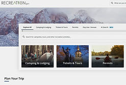
Start your search for developed campgrounds on recreation.gov. Search for "Lake Isabella California" and check on availability and amenities for each site.
Developed campgrounds are managed by a contractor/concierge of the US Forest Service.
Advenco (formerly Explore US,) is the concierge for the KRV area.
Day Use or or camping fees apply at all developed sites. Fees vary by location designated by a sign that says "Entering Fee Area."
Not all sites may be open or accept reservations.


Free campfire permits can be obtained at readyforwildfire.org/permits.
Watch a short video and take a brief quiz to obtain a permit.
Current restrictions prohibit the use of glass bottles around Lake Isabella or the Kern River.
Permits may be available at the Isabella Lake Fishing Derby, April 12, 13, and 14 at Derby HQ. Go to the derby page to learn about the Derby!
The Kern River Valley is a true "Sportman's Paradise," an area of stunning beauty with endless areas to explore and activities to participate in. Whether you're a hiker, climber, angler,windsurfer, marksman, skier, off-roader, hot-springs-soaker, cross-country skier, bird-watcher, and the list goes on and on, the Valley has something for you!
Check Out These Sites!
Most boats and other water-borne vessels require a lake permit from Kern County to legally be put on the water.
Permits can be purchased online at the link below or at Crossroads Shell in Lake Isabella or Sierra Gateway Market in Kernville.
Launch facilities located at developed camp ground sites may require a launch fee. Launch 19 at the main dam and the launch at the French Gulch do not require a fee.

Purchase fishing licenses online through the California Department of Fish and Wildlife or at Crossroads Shell in Lake Isabella, Sierra Gateway Market in Kernville, or other select merchants.
Free or discounted licenses may be available for select groups. See here.
Pro Tip: Download the CDFW app to keep a copy your license on your phone. You don't need to be connected to wifi to access it.
CDFW no longer prints copies of the annual fishing regulations. A PDF version of current freshwater fishing regulations booklet is available at this link.


There are two undeveloped or dispersed camping areas along the shores of the lake - Hanning Flat and Stein Cove dispersed camping areas. These are open areas with no fees and no reservations, but also no designated camping sites, fire rings amenities or hosts. Camping allowed up to 14 days. Fire, closure, and other restrictions still apply.
All other shoreline areas should be considered Day-Use only and must be vacated at dusk.
For questions/concerns about developed campground areas contact Advenco Western Divide manager Catherineat (661) 429-1599,
For questions about undeveloped or dispersed areas contact the Kern River Ranger District.
Sierra South - Rafting, Tubing, Climbing, Kayaking - Choose Your Adventure
Kern River's Edge Campground - A Great Blog with Lots of Local Info
And Check Out these Chamber Member Pages with even more info!


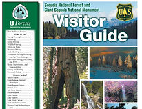
Features a comprehensive visitors guide to the Sequoia National Forest (caution, some of the info in the print version is outdated.)
Interactive map Includes an interactive map with highly customizable views and many features.
See HERE for a range of mapping apps, print, and other wayfinding resources available through USFS!

Outdoor recreation guide that includes detailed trail descriptions and information on mountain biking, rafting, snow play, and more.
Kern River Sierra produces the Kern River Sierra Outdoor Recreation Topo Map.
Available for purchase locally and online.

Holders of America the Beautiful Senior Passes and Access Passes may be entitled to a 50% discount on camping only. Restrictions may apply. Advenco also sells a Day Use Only pass good at all sites managed by them. Available from camp hosts for $60 dollars for the current calendar year. The Kern River Valley Chamber may also have passes available for purchase.
Discounts -
Quick Links
Camp Fire Permits -
readyforwildfire.org
Closures, Fire Restrictions -
Kern River Ranger District
Campground Reservations recreation.gov
Camping in Keyesville -
BLM
Cal. Dept. of Fish & Wildlife - Fishing Licenses
Regulations
Boating & Lake Permits -
Kern Co. Parks & Rec.
The Kern River Valley - A theme park designed by Mother Nature!
Includes dates of regular festivals and events, map of Lake Isabella, destinations, things to do, trails, fishing, local wildlife.


bottom of page


